
Lanes of O'Connell St.
Old Lanes of O'Connell Street
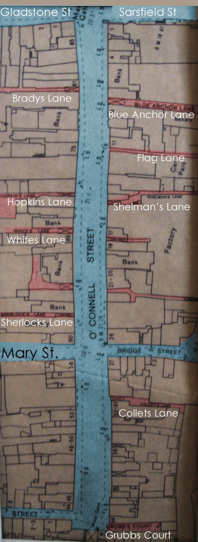
- There is a map of the street at the foot of this article.
Many of the lanes are now incorporated into adjacent premises. The map shows their positions, where known.
|
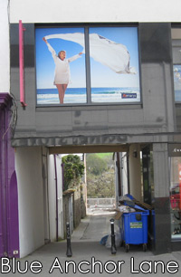
Blue Anchor LaneSituated between Nos. 8 & 9, beside Mahers Chemist.
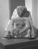
Named after a tavern there, it was also the Shambles Lane, where animals were butchered. It later became an unsavory area, and the shambles was moved to East Lane, in Gladstone St. Renovations uncovered a Sheila-na-Gig in the wall of the laneway. It is now in the National Museum.
|
|
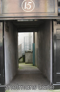
Shelman's LaneSituated between Nos. 15 & 16, to the left of Penneys Dept. Store. This lane was previously known as Shelmaden's Lane, c. 1841. |
|
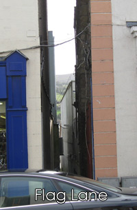
Flag LaneSituated between Nos. 11 & 12, to the left of the New Look Boutique. A long straight lane continuing down to Old Quay. It is one of the lanes not accorded a nameplate. |
|
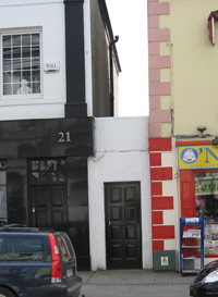
Dunphy's LaneThis lane is concealed behind a doorway to the right of O'Gormans Menswear, Nos. 20-21. It once extended down to the Old Quay. |
|
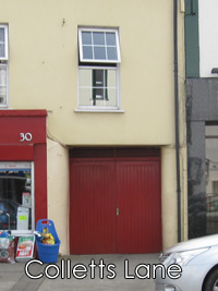
Collets LaneSituated between Nos. 30 & 31, Bob FitzGerald Menswear and Emerald Garden. John Collett was one of the earliest Quaker settlers in Clonmel, c. 1700. He lived in this lane, and so lent his name to it. He also provided the premises used as a Meeting House for the Society of Friends. |
Quins LaneSituated between Nos. 38-39 O'Connell St., at Joy's, Solicitors premises, the lane is gated. |
|
|
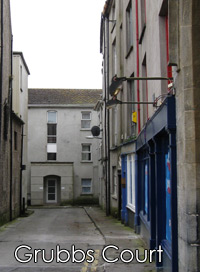
Grubbs CourtSituated at the Westgate, on the left side, this was originally known as Grubbs Lane, c.1841. |
|
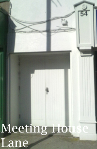
Meeting House LaneSituated between 53/54 O' Connell St., at Lifestyle Sports |
|
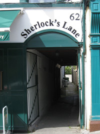
Sherlock's LaneSituated between Nos. 62 & 63, to the right of O'Gormans Coffee Shop. |
|
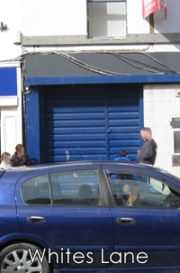
White's LaneSituated between Nos. 69 & 70, the gateway is incorporated into the old Ulster Bank premises. This lane may have been previously named Brahan's Lane or Mahony's Lane, as both these lanes existed in 1832, somewhere between Sherlock's and Hopkins' Lanes. See also Dumphys Lane, Cooneys Lane & Slatterys Lane down the page. |
|
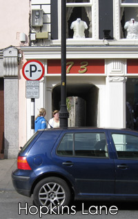
Hopkins LaneSituated at No. 73, between Major, Opticians & Fitzgeralds Menswear. At the end of Hopkins Lane, a 'dog leg' laneway led to Miser's Mall (c. 1841), situated roughly in the Mary St. Car Park, close to the present Marystone Mall laneway towards Gladstone St. |
|
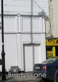
Bradys LaneSituated between Nos. 80 & 81, and incorporated into Dunnes Stores facade. It was colloquially known as Bradys Lane, as JP Brady had his premises there, with his bicycle repair shop at the end of the lane. This lane was previously known as Whelans Lane, c. 1841. |
Other Lanes, now gone.Dumphy's LaneThis was located between Sherlock's Lane (O'Gormans Cafe) and Whites Lane (Ulster Bank). It is the archway to the left side of the AIB premises, Nos. 64-65, and incorporated into the present facade of the bank. Cooney's LaneThis lane was also located somewhere between Dumphy's Lane, above, and Hopkins Lane (FitzGeralds Menswear). My belief is that it is also incorporated into the AIB facade, at the right hand side. No trace of it is visible, at least from the front. Slattery's LaneThis lane was located somewhere between Whites Lane (Ulster Bank) and Hopkins Lane (FitzGeralds Menswear), probably immediately to the left of Major Opticians. There is no visible sign of its former entrance. Evans LaneThis was located somewhere between Hopkins Lane (FitzGeralds Menswear) and Bradys Lane (Dunnes Stores), closer to the former lane. Looby's AlleySituated roughly between 85 and 86 O'Connell St, running parallel to Gladstone St. Cassins LaneSituated near the Westgate on the south side of the street, and extending towards the river. Around Nos. 41- 42 O'Connell St. (PC Fas). Quins LaneSituated between Nos. 38-39 O'Connell St., at Joy's, Solicitors premises, the lane is gated. |