Marlfield - Info
Marlfield Church
is situated at the village of Marlfield, 2-3 miles from Clonmel Centre. Coming from Clonmel, turn left, downhill, at the village crossroads. The church is clearly visible at the bottom of the road, on the left-hand side.Marlfield Church was built in 1818, on or close to the site of the mediaeval Inishlounaght Cistercian monastery. The large window to the rear of the church is the only external remnant of the original monastery that was incorporated into the building.
The church is located close to the crossroads in the village. Take the turn downhill towards the river (i.e. a 'left', if approaching the village from the Clonmel side). At the bottom of this road, the avenue to the church is on the left side. It is used occasionally by both the Roman Catholic and Church of Ireland faiths.
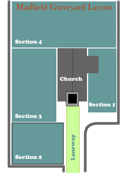
Marlfield Graveyard GPS Info: 52.344359, -7.744331
The headstones record the names of some eminent families, mostly Anglo-Irish, who made their marks on local and county business, and politics, mainly during the 1800's.
The Bagwell family is easily the most prominent among them, whose family estate was Marlfield House. The village of Marlfield is a creation of the Bagwells. They also owned much of Clonmel itself
The site has been subject to much flooding, but now, with work completed on the Clonmel Flood Relief Scheme, it should never again occur. Recent works (2014) have removed all the brambles, bushes, rats, etc., from the grounds. New grass has been set throughout, and the graveyard is once again a pleasant place to visit, thanks to local voluntary effort.
The Bagwell family is easily the most prominent among them, whose family estate was Marlfield House. The village of Marlfield is a creation of the Bagwells. They also owned much of Clonmel itself
The site has been subject to much flooding, but now, with work completed on the Clonmel Flood Relief Scheme, it should never again occur. Recent works (2014) have removed all the brambles, bushes, rats, etc., from the grounds. New grass has been set throughout, and the graveyard is once again a pleasant place to visit, thanks to local voluntary effort.
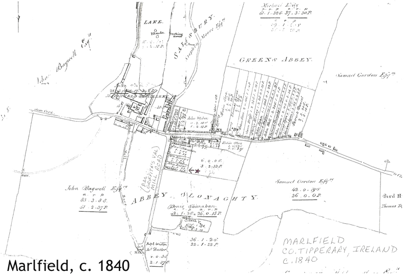
Old Map of area - c.1840